Our new open access study, led by Pleun, shows the importance of subkilometer atmospheric modelling and correct surface boundary conditions in areas with complex topography to accurately estimate catchment-scale meteorological variability.
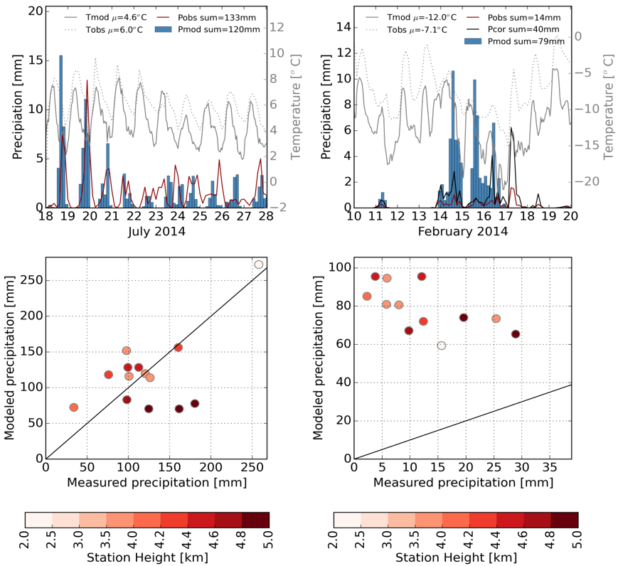
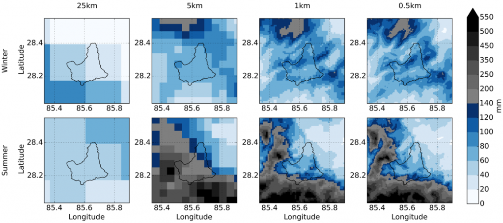
Frequently used gridded meteorological datasets poorly represent precipitation in the Himalayas because of their relatively low spatial resolution and the associated representation of the complex topography. Dynamical downscaling using high-resolution atmospheric models may improve the accuracy and quality of the precipitation fields. Therefore, we have used the Weather Research and Forecasting (WRF) Model to determine the resolution that is required to most accurately simulate monsoon and winter precipitation, 2-m temperature, and wind fields in the Nepalese Himalayas.
Results show that a high resolution of 500 m is computationally still feasible and provides the best match with the observations, gives the most plausible spatial distribution of precipitation, and improves the quality of the wind and temperature fields. Our findings suggest that, in combination with future improvements to atmospheric models for applications in complex terrain, subkilometer grid spacing may resolve catchment-scale meteorological variability more accurately. This will improve our capabilities to study glacio-hydrological changes at catchment and larger scale. Future modeling studies of High Mountain Asia should consider subkilometer grids to accurately estimate local meteorological variability.
P.N.J. Bonekamp, E. Collier, W.W. Immerzeel (2018), The Impact of Spatial Resolution, Land Use, and Spinup Time on Resolving Spatial Precipitation Patterns in the Himalayas, Journal of Hydrometeorology, 19, 1565-1581.


