The Save the Tiger! project performed by a consortium of seven partners and many local collaborators aims to study the grasslands in the Terai Arc Landscape (TAL) to sustainably provide habitat for tigers. By investigating the natural and anthropogenic factors affecting the grasslands, the project will develop strategies for conservation and sustainable water resources management. The research will be conducted in 23 nature reserves, with a focus on the Bardia National Park and the Karnali River in Western Nepal. The project will assess the impact of climate change and anthropogenic interventions on the grasslands and their interrelationships with river dynamics, groundwater, landcover, land-use, and grazing ungulates. The project will also develop landscape stewardship approaches and strategies for conservation in collaboration with local communities and authorities while raising public awareness to stimulate conservation of the tiger habitat.
Utrecht University’s Mountain Hydrology Team carries out the project’s work package 3: Hydrology of the mountainous Karnali catchment under climate and land use changes.
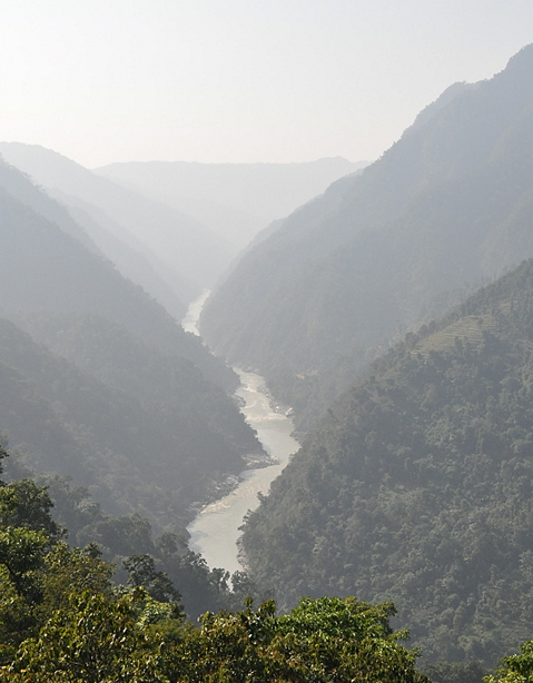
Karnali Catchment
The Karnali Catchment lies in western Nepal and covers an area of more than 40,000 km2 with many snow-fed rivers as its tributaries. A pristine river Karnali is the longest river in Nepal flowing through the mountains, hills and terai, finally joining Ganga in India. Studies have addressed the sensitivity of the Himalayan region to climate change and its impacts on the downstream hydrology of the rivers. With profound variability in the precipitation, rising temperature, extreme precipitation events and droughts, this study aims to access the impacts of climate change and land-use change on the water availability of the basin at Chisapani floodplain.
Research Objectives
In this project, team member Pranisha Pokhrel aims to find new hydrological insights for the Karnali River basin in the context of climate and land use changes. This includes understanding the spatial and temporal water balance and what changes have occurred during the last decade. Are these changes driven by climate or anthropogenic activities? How will the future water availability to the floodplain change and what will the main driver be? How can we adapt most effectively to these changes?
Approach
The research will focus on creating a well-calibrated and validated hydrological model using the latest version of SPHY v3.0. Bias-corrected future climate model inputs under different scenarios will be forced into the calibrated hydrological model to access the climate change impacts on future water availability. Spatio-temporal distribution of different water balance components including, precipitation, temperature and discharge in different sub-basins and in different seasons will be analyzed.
For the land-use change assessment, remote sensing and GIS will be used to extract information on land cover changes possibly due to driving factors like climate and socio-economic development. The traced information from the baseline period will be then used to create scenarios for the future to predict the water availability in the flood plains.
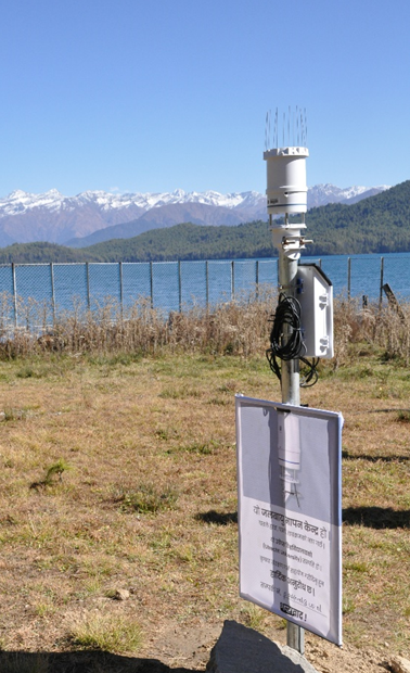
All the relevant in-situ hydrological and meteorological observations made to date are collected from the different organizations. The meteorological network in the basin was also established by setting up two meteo stations, and two tipping buckets and all of these were connected with soil measuring sensors at different depths. The devices were installed along the different elevations of the Karnali basin.