Mountain groundwater, previously assumed to be relatively trivial, can be an important water source to streams and can contribute more than 50% of low flow discharge. As climate change continues to shift precipitation phase, duration and intensity, to reduce snowpack and to accelerate glacier retreat, the water available to recharge mountain groundwater, and its capacity to sustain streamflow, is threatened.
Aims and objectives
In this project Caroline Aubry-Wake investigates how the quickly changing cryosphere, from retreating glaciers, declining snowpack and snowfall transitioning to rainfall, is affecting groundwater recharge, storage and discharge in high-mountain environments. Specifically, the aim is to:
- Quantify groundwater recharge, storage and discharge originating from glacier melt, snowmelt and precipitation in a high mountain catchment
- Assess the spatial and temporal variability of groundwater recharge and groundwater discharge to streamflow
- Provide estimate of future changes in groundwater dynamics linked to climate change
Approach
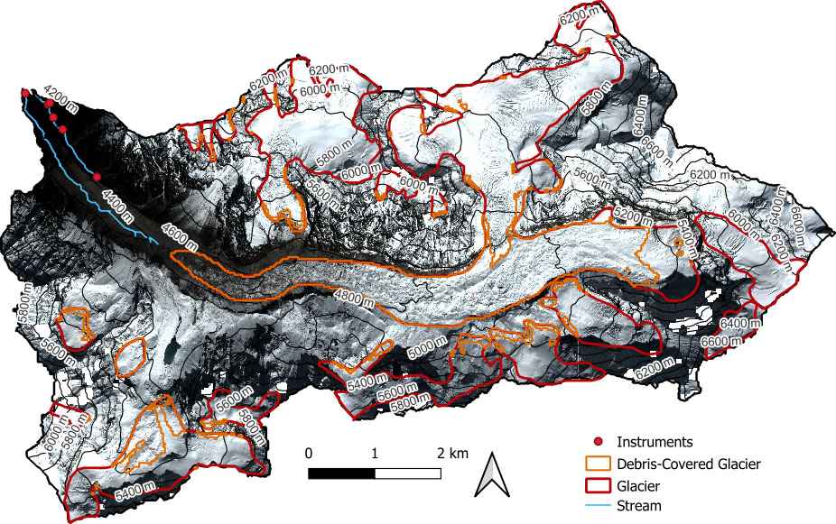
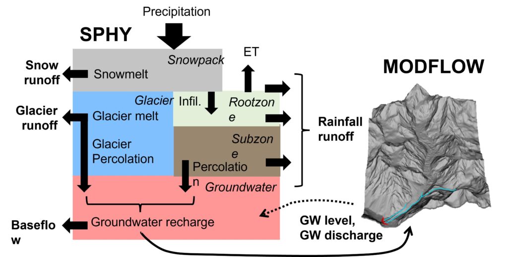
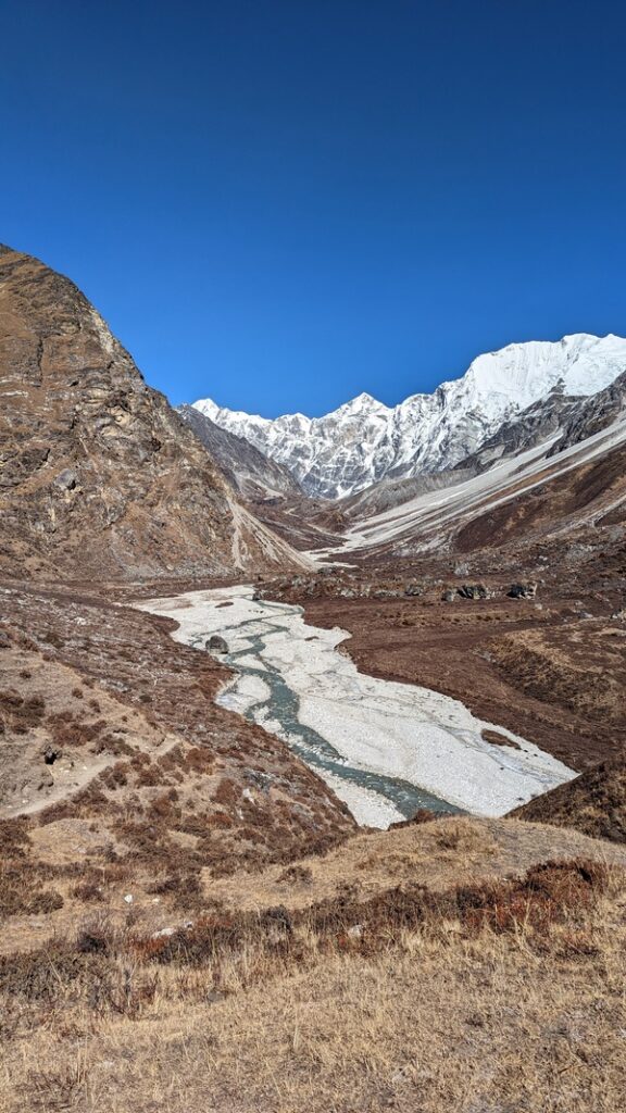
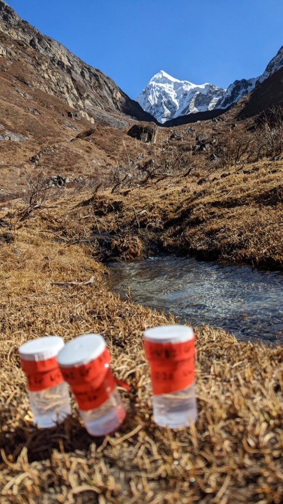
This project combines two modelling approaches to investigate the coupled surface water and groundwater components of a high elevation, highly glacierized basin. The surface water, including the snow and ice processes, are modelled using the Spatial Processes in Hydrology (SPHY) v3 model, a spatially distributed water balance model, and the groundwater component is modelled using the three-dimensional finite-difference groundwater flow model MODFLOW6. The combined model is applied to the Langshisha subbasin, a 56 km2 basin ranging between 4084 and 6940 m a.s.l., and evaluated with a combination of streamflow measurements, shallow observation wells and water geochemistry analysis. The model is set-up at 20 m resolution for the 2014-2022 period.
This modelling set-up will allow us to look into spatio-temporal groundwater processes occurring in the high mountains, and how these are changing with increased temperature, shifting precipitation patterns, reduced glacier extent and shorter snowpack seasonality.