The Indian Himalayan mountain range is the source area of several main rivers in India that provide a continuous freshwater supply for millions of people. Global warming raises serious concerns about the Himalayan river hydrology as it may affect the timing and magnitude of streamflow across the region. Understanding the seasonal impacts of different hydrological components such as snow- and rainfall, permafrost decay, glacier melt, and snowmelt is essential for future planning in water resources management and flood risk reduction.
Objectives
This project a work package of an ongoing project funded by the Swiss Agency for Development and Cooperation (SDC): “Developing a Glacio-Hydrological Model and IWRM plan for a selected Sub-basin in the Central Himalayas, Uttarakhand, India”. In this project climate change impacts on the hydrology of the Bhagirathi River are assessed, an important tributary of the Ganges, in the Indian Himalaya. This happens in collaboration with FutureWater, The Energy and Resources Institute (TERI), University of Geneva and Utrecht University. For this work package we aim to address the following objectives:
- Model streamflow and investigate glacio-hydrological components of the flow.
- Improve the existing model to include a more realistic presentation of different glacio-hydrological components.
- Provide future projections of glacier-fed Bhagirathi sub-basin.
- Develop a generic customizable modelling platform for upscaling to other glacier- and snow-fed sub-basins in India.
Approach
We will use the Spatial Processes in Hydrology (SPHY) open access model for this purpose, which has been used for many glacio-hydrological studies in the Ganges basin and broader Himalayan region. SPHY is a fully distributed model with specific parameterizations tailored to mountain hydrology, including snow melt, glacier melt, debris-covered glaciers and the energy balance.
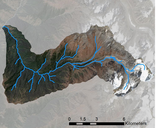
The model area for this project covers the Bhagirathi catchment. Three hydrological models are linked: (i) a distributed glacio-hydrological model for the Din Gad sub-catchment, (ii) a distributed glacio-hydrological model that covers the Bhagirathi sub-basin and makes use of findings and key parameters derived from the Din Gad catchment modelling, and (iii) a water allocation model that overlays the SPHY-Bhagirathi model in the downstream parts of the basin, where water demands are located (WEAP-PODIUMSIM Bhagirathi). This modelling toolset is forced with downscaled climate change projections and socio-economic projections to simulate future changes in water supply and demand in the sub-basin.
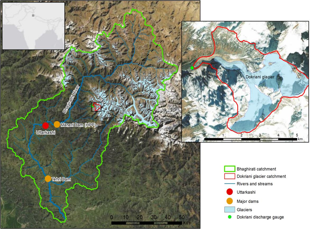
At Utrecht University, we have set-up the SPHY model for the Din Gad sub-catchment that includes the Dokriani glacier. We use the model at 50 m spatial resolution. For the current climate the model will be run for 1991-2020. To assess future climate change, the model will be run from 2020 until 2100 using projections based on the latest IPCC AR6 climate models. Based on the 1991-2020 simulations we will analyze seasonal variation in streamflow composition. We will make a distinction between streamflow contributions from the glacier, snow melt, rain runoff, groundwater and permafrost. We will analyse how this varies from month to month with a particular focus on the monsoon period. Simultaneously we will improve the existing model to include a more realistic presentation of different glacio-hydrological components. For the model calibration we will use the river discharge data, geodetic mass balance data, and remote sensing derived snow cover. Thermal imagery from Landsat 8 will be used to validate the permafrost modelling.