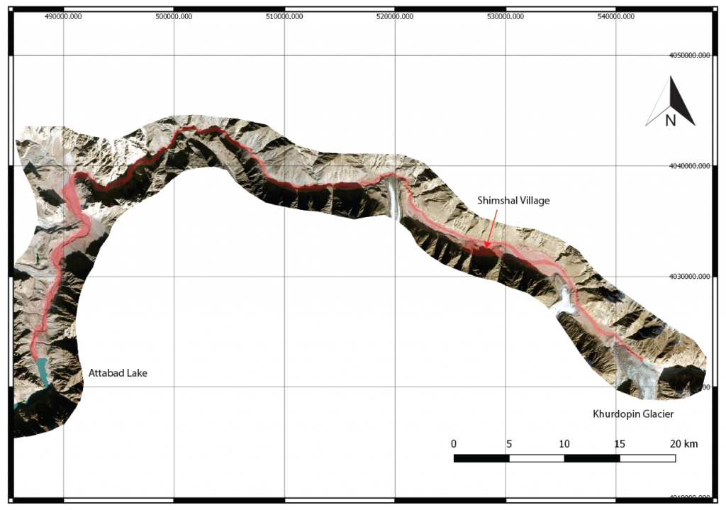
Recent observations show that the surging tongue of Khurdopin glacier in Shimshal catchment in Northern Pakistan has caused a lake to form in 2017 (Steiner et al. 2018), which might return annually in subsequent years following the melt season. Ongoing monitoring has shown that the lake expanded since November 2017 reaching a constant area of ca 350 000 m2 in March of 2018 and it has remained stable since. As the ice masses from the surge will take many more months to melt the lake is likely to remain or reappear even after drainage events. As the melt season starts the lake may drain and this may cause flooding downstream, in particular close to the village of Shimshal, the adjacent agricultural areas and lake Attabad located further downstream.
The mountain hydrology team of Utrecht University is supporting the Aga Khan Foundation for Habitat. The National Disaster Management Authority (NDMA) in Pakistan is coordinating the effort and is dealing with the emerging issue and have put together a team of experts. Our results may support this process.
To assess potential damage from a lake burst an initial BASEMENT hydrodynamic model was constructed for the area using available elevation models , estimated lake water volumes and dam breach scenarios from literature and an initial model simulation assuming a lake volume of 7 million m3 and a short breach period was conducted. The movie below shows the maximum inundation depth as the wave travels through the valley.
Subsequent work will focus on the following:
- Improve the cross profiles using field data or high resolution DEMs (e.g. ALOS-PRISM)
- Extend the model run until Attabad lake and assess the potential flood wave there.
- Include multiple volume and lake growth scenarios
- Include multiple breach scenarios ranging from a catastrophic, near instantaneous breach to a more gradual scenario
- Include more detailed exposure data such as infrastructure, houses, agricultural areas
For more information please contact Jakob Steiner or Walter Immerzeel.

