In the high mountains of Asia valley glaciers are pertinent features and an important water resource, both locally and downstream. In the vicinity of the mountains and in arid regions, their melt water can provide a sizeable contribution to stream flow and is of importance for cropland irrigation, drinking water and hydropower. Under future climate change, glacier melt water supply may change as glaciers will continue to lose mass because of rising temperatures. To better understand how this part of the future water balance will change, it is important to improve our knowledge of glacier dynamics from small to large scale.
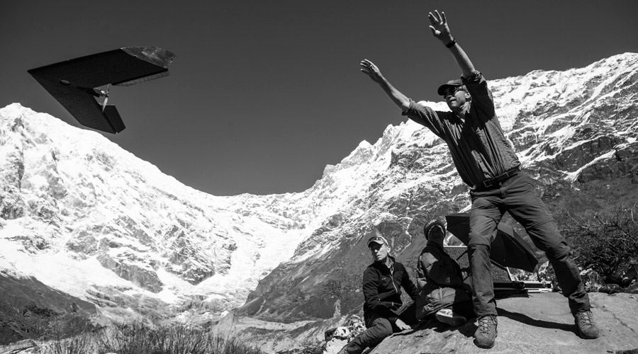
The glaciers in the high mountains of Asia are generally difficult to study due to their inaccessibility. Debris-covered glaciers have particularly been understudied, partly due to the complications the debris layer imposes on fieldwork. Satellite remote sensing enables analyses of remote debris-covered glaciers, but spatial resolution is generally too limited for detailed analysis of the small-scale effects of the debris layer on local ice melt. Recent advances in unmanned aerial vehicle (UAV) technology offer a promising complimentary observation method, as UAVs enable on demand acquisition of imagery and elevation data at very high spatial and temporal detail. In IceSpy, our understanding of debris-covered glaciers and their surface processes is improved in five separate studies by exploring the value of UAVs in the research of these glaciers.
Exploring the value of UAVs in the research of glaciers.
Project output
1. HIGH-RESOLUTION THINNING AND VELOCITY
For the first time, a debris-covered glacier in the Himalaya was monitored by a UAV before and after the melt season. Based on stereo-imaging and the Structure-from-Motion algorithm, highly detailed orthomosaics and digital elevation models (DEMs) were derived and used to determine elevation changes and surface flow in unprecedented detail. It was shown that the surface of the glacier experiences highly heterogenous mass wasting and that ice melt is considerably higher near ice cliffs and supraglacial ponds.
2. SEASONAL SURFACE VELOCITIES
Continued UAV surveys enabled a comparison of summer and winter surface velocities of the debris-covered glacier. The seasonal surface velocities were derived by exploring the potential of frequency cross-correlation techniques for the high-resolution UAV imagery. Large differences were shown to exist between the two seasons, with limited flow during summer and practically stagnant ice in winter.
3. MAPPING SURFACE TEMPERATURES
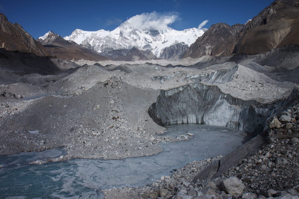
Supraglacial debris significantly alters the surface energy balance of a glacier. Data on spatially distributed debris surface temperature can provide important information on the properties of the debris, its effects on the ice below and its influence on the near-surface boundary layer. Therefore, a methodology was developed to acquire corrected surface temperature maps of a debris-covered glacier from a UAV equipped with a thermal infrared camera.
4. AUTOMATIC SURFACE FEATURE DETECTION
Ice cliffs and supraglacial ponds on debris-covered glaciers were shown to cause highly heterogenous surface melt. To improve understanding of these surface features an object-based image analysis procedure was presented that enables their automated delineation, which allows for objective analysis of ice cliff characteristics and spatial distribution.
5. FUTURE OF ASIA’S GLACIERS
UAV data primarily provides data on the small to moderate scale. To understand the effects of climate change and debris-covered glaciers on the large scale, the UAV findings are incorporated in a large-scale model that assesses transient glacier mass loss over the 21st century. It was shown that even if climate change is limited over one third of the current glacier mass will disappear by the end of the century, and that more severe mass losses are more likely. Supraglacial debris is shown to be able to provide considerable retention of glacier mass in Asia.
View interactive web map of this study.
To learn more about this project, refer to the PhD thesis of Philip Kraaijenbrink, which can be downloaded here.